Maps can tell us a lot about the history of our landscape, if you know how to ‘read’ them.
The shape and size of fields, the bends in a road or the scatter of buildings can reveal much about how the landscape has evolved.
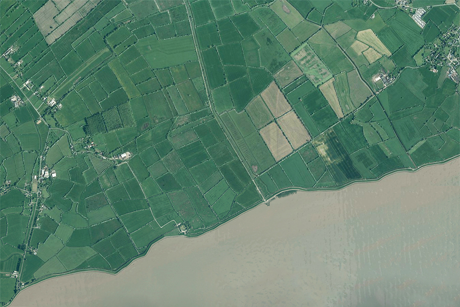
Take a look at the modern map and aerial photograph of Goldcliff and Nash below. Many of the reens and ditches that drain the land meander across the landscape, creating small, irregular-shaped fields.
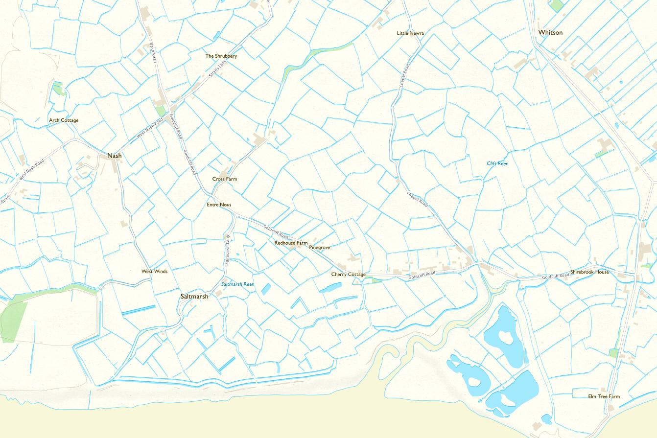
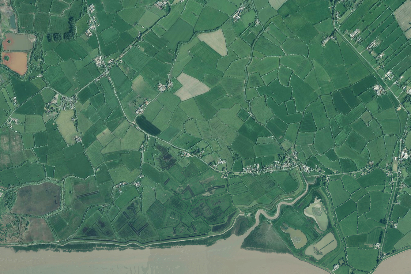
© Crown Copyright. All rights reserved. RSPB licence 100021787, RSPB Permit Number: 60271.
Following the departure of the Romans in the early 5th century, the sea defences failed, and the Levels reverted to wetlands, with perhaps a few scattered farmsteads on higher ground. Over hundreds of years, tides and floods buried the Roman landscape under several metres of silt.
When the Normans arrived in the 11th century, like the Romans before them, they recognised the value of the Levels for grazing. The land between Goldcliff and Nash was given to the newly-founded Goldcliff Priory by the Lord of Caerleon, and the monks began the enormous task of taming the wild marshes.
They rebuilt the sea defences along the coast and began to drain the land, starting at the higher ground on the coast and working their way inland. The earliest settlements at this time tended to be associated with roughly oval-shaped areas protected by embankments, and it is still possible to trace the outline of some of these areas on modern maps, such as at Nash church, Chapel Tump (near Undy) and St Brides in the Wentlooge Level.

At this time, the Levels were crossed by numerous streams, rivers and tidal creeks. To save time, labour and expense, the monks adapted many of the existing watercourses, connecting them together. They installed ‘gouts’, or tidal gates, at the seaward ends and ‘stanks’, or sluice gates, along their length. This created a simple gravity-fed system that allowed precise control of the water levels, reducing flooding in winter and retaining water in summer, which helped to produce lush grazing for sheep and cattle. The same system, with minor improvements, is still in use today.
The medieval farmland around Nash and Goldcliff therefore developed in a rather haphazard, unplanned way, a pattern which is still evident 900 years later.
The back-fen
On the Levels, the land by the coast is generally slightly higher and drier than that further inland. These low-lying inland areas, called back-fen, were traditionally the wettest and hardest to drain. Medieval reclamation of the Levels stopped at the edges of the back-fens that remained open and relatively wild until much later. They were used as summer grazing and are often referred to as ‘moors’. Occasionally the names used for the back-fen reflected a poor regard for the land; the back-fen at Llanwern, now occupied by the steel works, was called ‘Rotten Land’.
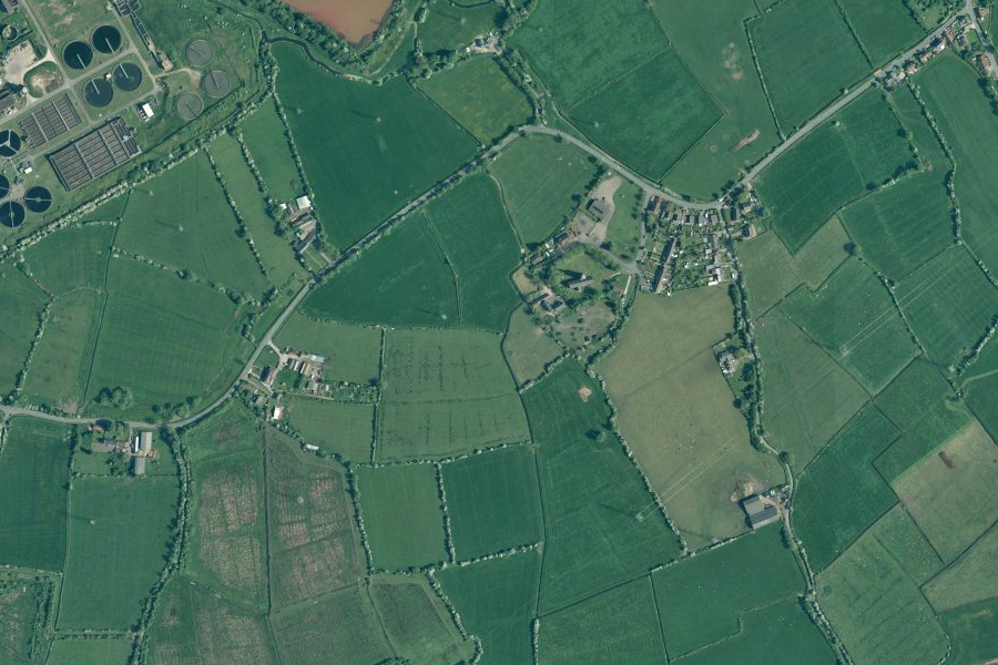
As the population increased, and labour became more readily available, it eventually became possible to drain the back-fen. By the late 19th century all of the open moors had been enclosed and drained as part of a deliberate policy. On the map, these later fields appear larger and more regular in shape, showing that they are part of a planned landscape.
More regular-shaped fields indicate a planned, post-medieval landscape:
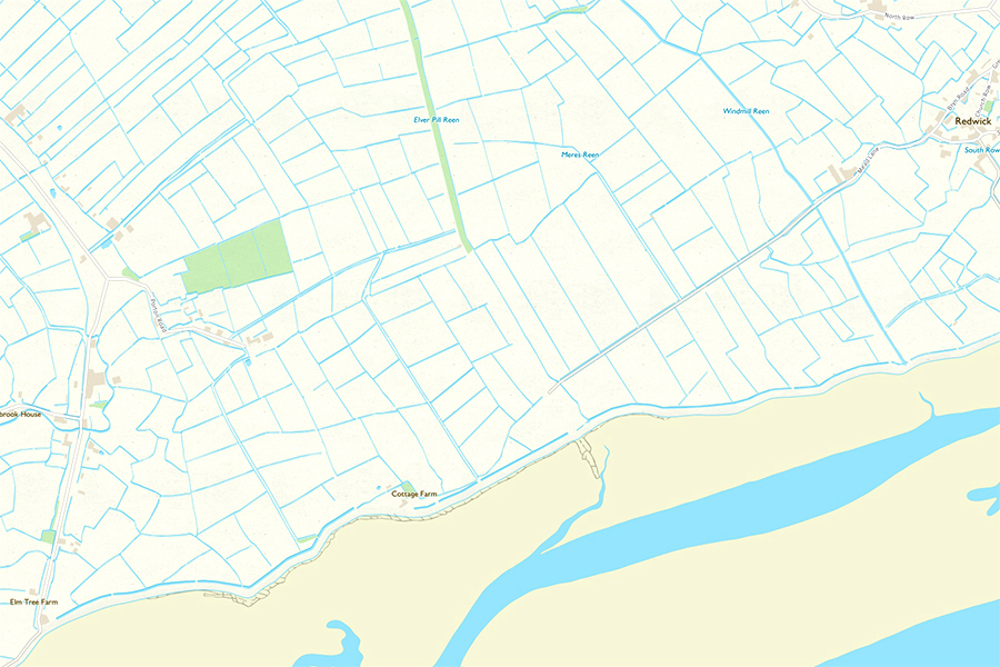
© Crown Copyright. All rights reserved. RSPB licence 100021787, RSPB Permit Number: 60271.


![Wesleyan Methodist chapel Castleton (Penny Gregson)[2].jpg](https://images.squarespace-cdn.com/content/v1/5a1d5fb38a02c70db7c34f81/fe4960cd-db68-469d-8411-f5e21327e383/Wesleyan+Methodist+chapel+Castleton+%28Penny+Gregson%29%5B2%5D.jpg)