Archaeology
Archaeology group, Peterstone Great Wharf
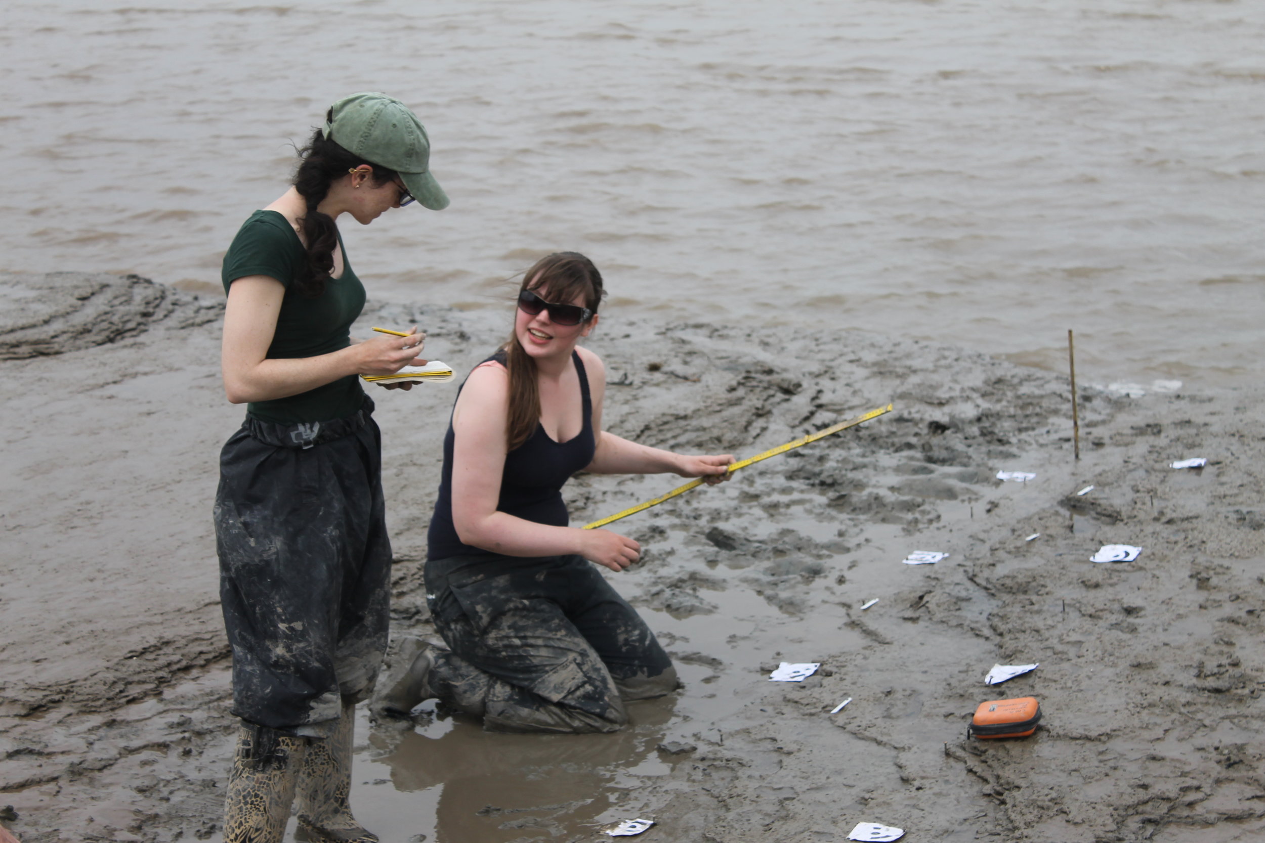
Over recent years, a range of spectacular archaeological sites have been discovered and excavated on the Levels.
Recurrent phases of flooding (inundation) over many centuries have created extensive, buried, waterlogged, archaeological and environmental deposits belonging to earlier landscapes, which extend beyond the seawalls and banks into the intertidal mudflats. The particular nature of the waterlogged soils on the Levels means that many of the archaeological deposits are extraordinarily well preserved.
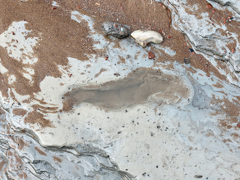
These include the remains of Neolithic/Bronze Age settlement sites, as evidenced by human footprints, lithic finds, butchered animal bone, brushwood trackways and roundhouses (e.g. in the vicinity of Collister Pill).
The national importance of the inter-tidal area for its uniquely rich archaeological and historical resource is recognised by its inclusion in the Gwent Levels Registered Historic Landscape. The Levels are therefore a uniquely rich archaeological and historical resource in Wales, and certainly of international significance.
Many of the most important and remarkable archaeological discoveries on the Levels are thanks to local amateur archaeologist Derek Upton. He spent much of his spare time exploring along the coast of the Severn Estuary, discovering the Mesolithic human footprints at Magor and Uskmouth, Bronze Age sites at Caldicot and Redwick and the medieval Magor Pill Boat, amongst others. His work led to the establishment of the Severn Estuary Research Committee and a national recognition of the importance of the Levels and coastal archaeology.
The Gwent Levels is included in the Register of Historic Landscapes in Wales. For more details visit the The Trust for Welsh Archaeology (Heneb) web site.


The area is especially rich in prehistoric and Roman Period archaeology, as well as a diversity of field patterns ranging from the ancient semi-regular enclosure to the engineered 18th century fields. The unique drainage history and important farming and food production history have provided today’s communities with a strong sense of tradition and place.
Examples of notable prehistoric features to the north of Wentlooge Level outside, but near the Registered Historic Landscape, include the early Bronze Age long barrow tomb near Cleppa Park visible from the M4; Gaer Fort, also known as Tredegar Fort and, locally, as The Gollars, on the western side of the City of Newport, an old hill fort site believed to be from the Iron Age; and an Iron Age Druid stone in the grounds of a private property in Michaelstone.
Bronze Age activity has been recorded at various sites on desiccated raised peat beds, such as at Chapel Tump and Goldcliff. More recently, at Caldicot Castle there is detailed evidence of palaeochannels, pile structures, a boat strake (a strip of planking in a wooden boat) and a considerable amount of cultural material.
Iron Age evidence has been discovered in the intertidal zone at Goldcliff, with rectangular timber buildings, trackways and fishtraps on a shelf of fen peat. Also outside, but near the area, at Barland's Farm, Wilcrick, Roman stone and timber structures have been found, along with the remains of a late 3rd Century Romano-British boat, emphasizing the remarkable state of preservation of archaeological material in and around the Levels.
Remains of an Iron Age trackway in the intertidal zone at Goldcliff
The Middle Ages are represented by a large number of Anglo-Norman sites including castles, moated sites, churches, mills, manor houses and court houses. There is evidence of continuity in the forms of land use between the medieval and post-medieval periods.
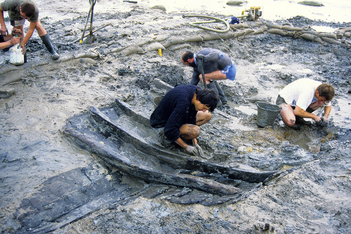
The remains of a 13th-century boat, used for trading along and across the Severn Estuary, and perhaps with Ireland, were found buried in the mud of the estuary close to Magor Pill. The boat was found to have been carrying iron ore from Glamorgan. It is the largest wreck find of its period in Welsh waters and probably the largest found so far in the British Isles.
The present landscape represents the latest archaeological period and provides the diverse ecological niches on which the nature conservation interests depend.
Professor Martin Bell presents a virtual archaeological field trip to Goldcliff:


Archaeology in the Severn Estuary
The Severn Estuary Levels Research Committee (SELRC) publishes an annual journal entitled Archaeology in the Severn Estuary. These are available free from the Archaeology Data Service (ADS) website.