Love history? Join archaeologists starting a brand new search for historic sites on the Gwent Levels !
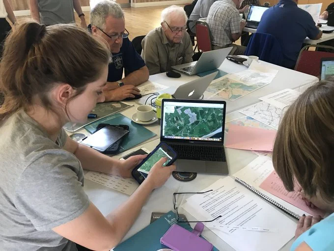
This is the first in a new series of workshops where archaeologists and local history-lovers will work together to locate, investigate and identify the levels landscape. Using 3D LiDAR (laser) models and digital maps (GIS -Geographic Information Systems), we’ll show you how to spot things of historical significance, and figure out what they are.
Our aim is to use this new technology to reveal more about our historic landscape and to share this via our interactive online map for exploring the Gwent Levels through the ages You’ll learn how archaeologists search for sites in the landscape, and try finding some for yourself.
Join us to help put history back on the map!
FAQs
Who is this event suitable for? Anyone aged 12+ who is interested in history, and how archaeologists discover new sites.
What do I need to bring? We’ll provide plenty of tea and biscuits, but you will need to bring: - A tablet or laptop - Packed lunch If you are unable to bring your own laptop, please let us know - we may have a couple of spares
Who is organising the event? This event is part of Living Levels, and is being run by DigVentures, together with local residents, historians, archaeologists, archivists, and anyone who is even just a little bit interested in history.
Through these workshops and community input we're aiming to create an online map together showcasing the area's extraordinary history.